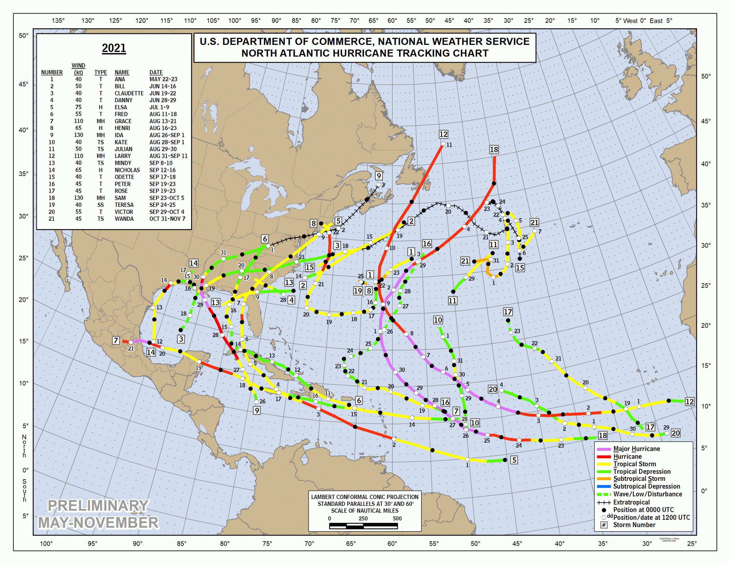
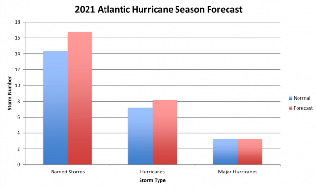
2021 became the third most active season on record with 21 named storms, and the sixth year in a row of above average of storms of prior seasons. April forecasts projected slightly higher activity than average.
The first named storm Ana formed May 22, earlier than the official start of the Atlantic hurricane season of June 1 to November 30.
July 1 began with Hurricane Elsa, an early strong storm, causing major damage to Barbados then again on the US east coast after crossing northern Florida and Georgia.
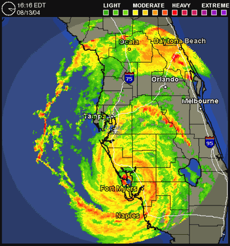
The forecast trajectory of Elsa put Anna Maria Island on watch several days ahead for proximal impact but the storm weakened as it traveled up the west gulf coast as a tropical storm and passed by with below gale force wind and minor rain. The highest gust reported at Sarasota Airport was 54mph. About 2.8” rain fell locally. One Florida man was killed by a falling tree.

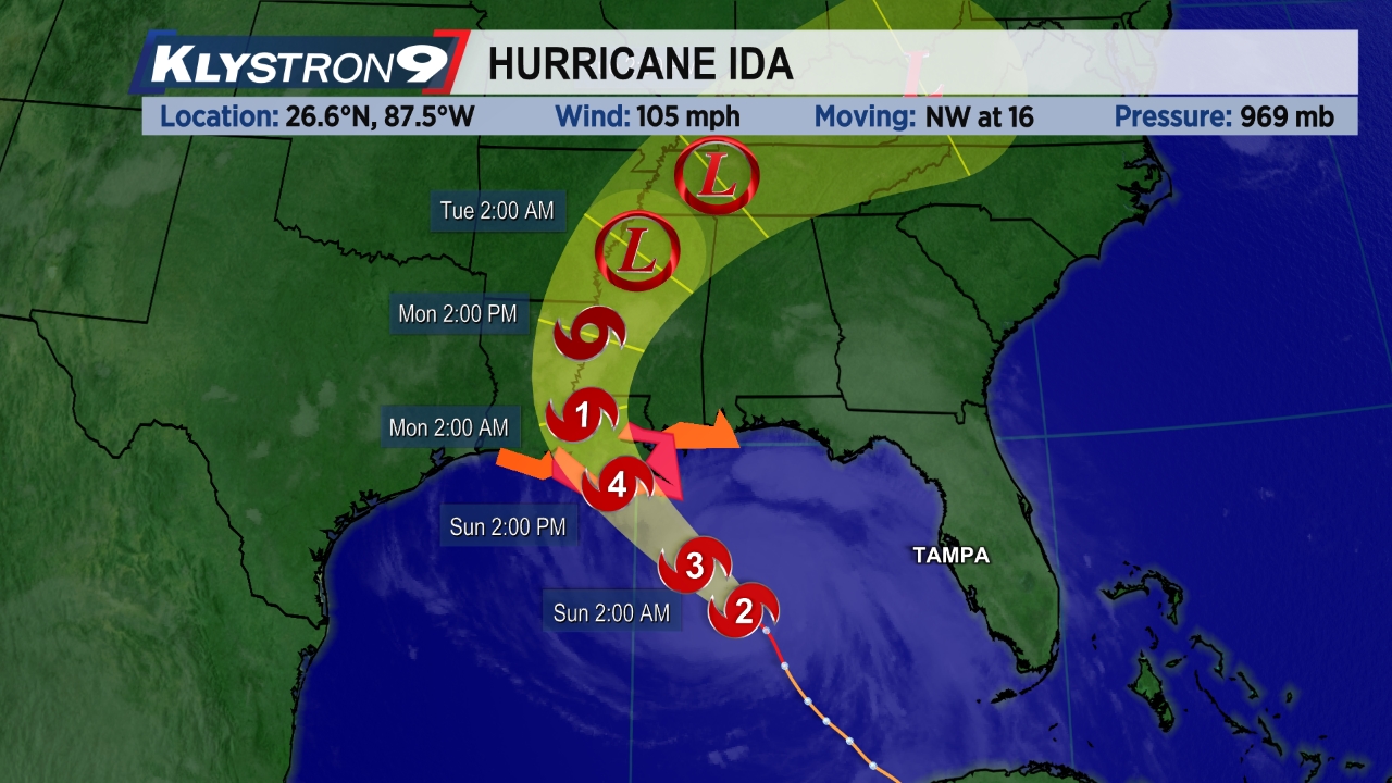
Hurricane Ida began August 23 in the Caribbean Sea and intensified rapidly into a category 1 hurricane as it hit Cuba with 80mph winds. Then Ida continued to strengthen over the warm Gulf of Mexico waters into a category 4 storm with 150mph winds, making landfall in Louisiana at a wind strength tying the records of 1856 and 2005 (Katrina).
Anna Maria Island and Florida west coast were unaffected.
The complete list of 2021 Atlantic named storms:
| Name | Date | Category | Max Wind | Affected |
| Ana | May 22 – 23 | TS | 45 | Bermuda |
| Bill | June 14 – 15 | TS | 65 | East Coast of the United States, Atlantic Canada |
| Claudette | June 19 – 22 | TS | 45 | Southern Mexico, Southern United States, Atlantic Canada |
| Danny | June 27 – 29 | TS | 45 | South Carolina, Georgia |
| Elsa | July 1 – 9 | Cat 1 | 85 | Lesser Antilles, Venezuela, Greater Antilles, South Atlantic United States, Northeastern United States, Atlantic Canada, Greenland, Iceland |
| Fred | August 11 – 17 | TS | 65 | Lesser Antilles, Greater Antilles, The Bahamas, Southeastern United States, Eastern Great Lakes Region, Northeastern United States, Southern Quebec, The Maritimes |
| Grace | August 13 – 21 | Cat 3 | 125 | Lesser Antilles, Greater Antilles, Yucatan Peninsula, Central Mexico |
| Henri | August 16 – 23 | Cat 1 | 75 | Bermuda, Northeastern United States, Southern Nova Scotia |
| Ida | Aug 26 – Sep 1 | Cat 4 | 150 | Venezuela, Colombia, Cayman Islands, Cuba, Southern United States, Northeastern United States, Atlantic Canada |
| Julian | Aug 28 – 30 | TS | 60 | None |
| Kate | Aug 28 – Sep 1 | TS | 45 | None |
| Larry | Aug 31 – Sep 11 | Cat 3 | 125 | Lesser Antilles, Bermuda, East Coast of the United States, Nova Scotia, Newfoundland, Saint Pierre and Miquelon, Greenland |
| Mindy | Sep 8 – 10 | TS | 45 | Colombia, Central America, Yucatán Peninsula, Florida, Georgia, South Carolina |
| Nicholas | Sep 12 – 16 | Cat 1 | 75 | Mexico, Gulf Coast of the United States |
| Odette | Sep 17 – 18 | TS | 45 | East Coast of the United States, Atlantic Canada |
| Peter | Sep 19 – 23 | TS | 50 | Hispaniola, Leeward Islands, Puerto Rico |
| Rose | Sep 19 – 23 | TS | 50 | None |
| Sam | Sep 22 – Oct 5 | Cat 4 | 155 | West Africa, Leeward Islands, Puerto Rico, Bermuda, Iceland |
| Teresa | Sep 24 – 25 | Sub TS | 45 | Bermuda |
| Victor | Sep 29 – Oct 4 | TS | 65 | None |
| Wanda | Oct 31 – Nov 7 | TS | 50 | Southern United States, Mid-Atlantic states, Northeastern United States, Bermuda, Atlantic Canada |