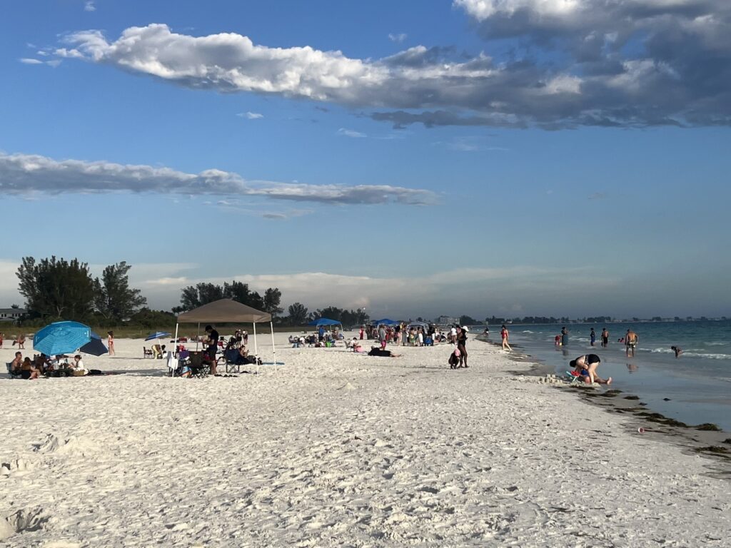

Anna Maria Island residents in Holmes Beach, Bradenton Beach, and Anna Maria City can dispose of household hazardous waste at a collection station to be set up January 27, 2024, by Manatee County. Hours will be 9am – 3pm on the Gulf side parking lot of Coquina Beach Park.
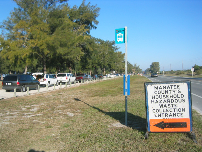
Coquina Beach, Manatee County E-Scrap Hazardous Waste Collection
2022 season storms brought extensive and expensive damage to parts of Florida and Puerto Rico. Anna Maria Island experienced a relatively quiet season with the exception of Hurricane Ian. Storm damage was mainly to roof shingles and soffits in the 40-80mph winds.
There were 14 named storms of greater than gale force wind, same as recent year average. Of these, eight intensified to hurricane strength of over 72 mph, two of these became major hurricanes of over 111 mph sustained winds. Notably, August was the first time since 1997 that there was no storm at all.
Hurricane Ian tied for the fifth-strongest hurricane ever to make landfall in the U.S., at Category 4 with 150 mph maximum sustained winds. Ian posed a severe threat to the southwest coast of Florida as it intensified after crossing the Dry Tortugas of Florida Keys September 28, then slammed into Costa Cayo near Punta Gorda, transited central Florida and exited the state at Cape Canaveral. It then continued north and made a third landfall at Georgtown South Carolina.
Hurricane Fiona made landfall as a Category 1 at Puerto Rico.
Hurricane Niccole was the season’s third U.S. landfall at Hutchinson Island Florida as a Category 1.
The forecast trajectory of Hurricane Ian put Anna Maria Island on watch several days ahead for proximal impact. The storm strengthened as it traveled up the west gulf coast. Expectations of a major catastrophe were in everyone’s minds as residents prepared to evacuate inland.
Authorities issued mandatory evacuation orders, meaning local emergency services would not be available if people stayed. Usually the loss of electricity can be expected but alternative resources can be planned. Controversially they ordered the water supply shut off early in the days before the storm’s forecast arrival. Once off the island, return would require an official permit. Most people evacuated whether they wanted to or not.
As the forecast path fluctuated left and right, the angle of approach made projected landfall vary by 100’s of miles. Being on the east or west side of a counterclockwise rotating hurricane center can make a huge difference in wind strength and resultant impact.
Similarly to Hurricane Charley in 2004, Hurricane Ian trended right during the last few hours before landfall, lashing Anna Maria Island with gusty winds from the north but little rain, and no storm surge, while exploding into Captiva Island 70 miles south, leaving a devastating wake of crushed and submerged houses, downed trees, washed out bridge to the mainland, and flooded cars and boats over a wide swath from Fort Myers to Port Charlotte and inland. Storm surge was reported to be up to 18 feet above sea level. 114 people died.
Hurricane Nicole made an east coast landfall near Vero Beach, Florida, with 75 mph (120 km/h) sustained winds. Nicole then weakened to a tropical storm inland, as it moved across Central Florida. Later that day, its center briefly emerged over the Gulf of Mexico, north of Tampa, before moving onshore again northwest of Cedar Key. Impact on Anna Maria Island was minimal.
Complete List of Storms 2022
Name
Date
Cat
Max wind mph (km/h)
Areas affected
Deaths
Alex
June 5–6
TS
70 (110)
Yucatán Peninsula, Western Cuba, Florida, Northern Bahamas, Bermuda
4
Bonnie
July 1–2
TS
50 (85)
Trinidad and Tobago, Grenada, Colombia, Venezuela, ABC Islands, Central America (before crossover)
4
Colin
July 1–2
TS
40 (65)
South Atlantic United States
1
Danielle
September 1–8
Cat 1
90 (150)
Western Iberian Peninsula
None
Earl
September 3–10
Cat 2
105 (165)
Northern Leeward Islands, Puerto Rico, Bermuda, Newfoundland
2
Fiona
September 14–24
Cat 4
130 (215)
Lesser Antilles, Puerto Rico, Dominican Republic, Eastern Bahamas, Turks and Caicos Islands, Bermuda, Eastern Canada
31
Gaston
September 20–26
TS
65 (100)
Azores
None
Ian
September 23–30
Cat 4
155 (250)
Trinidad and Tobago, Venezuela, Colombia, ABC islands, Jamaica, Cayman Islands, Cuba, Southeastern Coast of the United States
?157
Hermine
September 23–25
TS
40 (65)
Canary Islands
None
Eleven
September 28–29
35 (55)
None
None
Twelve
October 4–7
35 (55)
None
None
Julia
October 7–9
Cat 1
85 (140)
Trinidad and Tobago, Venezuela, ABC Islands, Colombia, Central America (before crossover)
91
Karl
October 11–15
TS
60 (95)
Southern Mexico
3
Lisa
October 31 – November 5
Cat 1
85 (140)
Jamaica, Cayman Islands, Central America
None
Martin
November 1–3
Cat 1
85 (140)
None
None
Nicole
November 7–11
Cat 1
75 (120)
The Bahamas, Southeastern Coast of the United States
2021 became the third most active season on record with 21 named storms, and the sixth year in a row of above average of storms of prior seasons. April forecasts projected slightly higher activity than average.
The first named storm Ana formed May 22, earlier than the official start of the Atlantic hurricane season of June 1 to November 30.
July 1 began with Hurricane Elsa, an early strong storm, causing major damage to Barbados then again on the US east coast after crossing northern Florida and Georgia.
The forecast trajectory of Elsa put Anna Maria Island on watch several days ahead for proximal impact but the storm weakened as it traveled up the west gulf coast as a tropical storm and passed by with below gale force wind and minor rain. The highest gust reported at Sarasota Airport was 54mph. About 2.8” rain fell locally. One Florida man was killed by a falling tree.
Hurricane Ida began August 23 in the Caribbean Sea and intensified rapidly into a category 1 hurricane as it hit Cuba with 80mph winds. Then Ida continued to strengthen over the warm Gulf of Mexico waters into a category 4 storm with 150mph winds, making landfall in Louisiana at a wind strength tying the records of 1856 and 2005 (Katrina).
Anna Maria Island and Florida west coast were unaffected.
The complete list of 2021 Atlantic named storms:
Name
Date
Category
Max Wind
Affected
Ana
May 22 – 23
TS
45
Bermuda
Bill
June 14 – 15
TS
65
East Coast of the United States, Atlantic Canada
Claudette
June 19 – 22
TS
45
Southern Mexico, Southern United States, Atlantic Canada
Danny
June 27 – 29
TS
45
South Carolina, Georgia
Elsa
July 1 – 9
Cat 1
85
Lesser Antilles, Venezuela, Greater Antilles, South Atlantic United States, Northeastern United States, Atlantic Canada, Greenland, Iceland
Fred
August 11 – 17
TS
65
Lesser Antilles, Greater Antilles, The Bahamas, Southeastern United States, Eastern Great Lakes Region, Northeastern United States, Southern Quebec, The Maritimes
Grace
August 13 – 21
Cat 3
125
Lesser Antilles, Greater Antilles, Yucatan Peninsula, Central Mexico
Henri
August 16 – 23
Cat 1
75
Bermuda, Northeastern United States, Southern Nova Scotia
Ida
Aug 26 – Sep 1
Cat 4
150
Venezuela, Colombia, Cayman Islands, Cuba, Southern United States, Northeastern United States, Atlantic Canada
Julian
Aug 28 – 30
TS
60
None
Kate
Aug 28 – Sep 1
TS
45
None
Larry
Aug 31 – Sep 11
Cat 3
125
Lesser Antilles, Bermuda, East Coast of the United States, Nova Scotia, Newfoundland, Saint Pierre and Miquelon, Greenland
Mindy
Sep 8 – 10
TS
45
Colombia, Central America, Yucatán Peninsula, Florida, Georgia, South Carolina
Nicholas
Sep 12 – 16
Cat 1
75
Mexico, Gulf Coast of the United States
Odette
Sep 17 – 18
TS
45
East Coast of the United States, Atlantic Canada
Peter
Sep 19 – 23
TS
50
Hispaniola, Leeward Islands, Puerto Rico
Rose
Sep 19 – 23
TS
50
None
Sam
Sep 22 – Oct 5
Cat 4
155
West Africa, Leeward Islands, Puerto Rico, Bermuda, Iceland
Teresa
Sep 24 – 25
Sub TS
45
Bermuda
Victor
Sep 29 – Oct 4
TS
65
None
Wanda
Oct 31 – Nov 7
TS
50
Southern United States, Mid-Atlantic states, Northeastern United States, Bermuda, Atlantic Canada
2021 is likely to be “near normal” in terms of tropical activity, though there is more risk of an active season. Impacts from landfalling hurricanes could shift eastward this season toward the U.S. East Coast and the Leeward Islands.
The forecast for the 2021 Atlantic Hurricane Season from June-November shows the likelihood for a near normal season, with
tropical cyclone activity at ~107% of normal anticipated
range of activity from 97-119% of normal
17 named storms (average 14)
8 hurricanes (average 7)
3 major hurricanes (average 3)
Unlike last season, the 2021 outlook does not include a hyperactive season within the expected range of outcomes, though there is very little chance for below normal activity this season. It should be noted that a “normal hurricane season” now represents higher levels of tropical activity in all aspects because of the climatology update uses 1991-2020 as the baseline instead of 1981-2010 period used previously. If 2021 outlook was issued based on the previous climatology, the forecast would call for an active season instead of a near normal one.
The Greek alphabet will no longer be used to extend the named storms’ list. If all names in the first list have been used, a supplemental list will begin.
Background: The major ocean basins’ data support a near to above normal season of tropical activity once again. Beginning with ENSO (El Niño Southern Oscillation), there is an 80% chance of neutral or La Niña conditions being in place by the August-October peak of hurricane season, with only a 20% chance of El Niño.
La Niña is the most favorable state for active Atlantic seasons as it supports low vertical wind shear needed for tropical cyclone formation and intensification, so the strong likelihood of neutral or La Niña conditions in 2021 suggests an active year while the slight El Niño chance reduces that potential.
The Atlantic Multi-decadal Oscillation (AMO) shows an 80% chance to be in its favorable warm Sea Surface Temperature (SST) phase for Atlantic tropical activity.
The largest question is the Indian Ocean Dipole (IOD), which has a connection to Atlantic occurrence of dry air that suppresses tropical cyclone formation. In 2021, there are questions about the state of the IOD by August-October, which supports a nearer to normal hurricane season.
The most reliable forecast variable is Accumulated Cyclone Energy (ACE), which is widely viewed as the best measure of cyclone activity instead of the total named storm number and hurricane number. Since tropical cyclones vary wildly in duration from 1-10+ days, similar numbers of storms in different years can still represent very different levels of activity.
The spread among the storms is relatively narrow, with 20% of the years showing below normal activity while the other 80% showed above normal activity. Due to the narrow range among prior years relative to the new normal level of activity, 100% of the prior years used in the forecast are in the “near normal” range. This results in a high confidence outlook for near to above normal activity in 2021, with the direction of ENSO and the IOD being the key issues to monitor.
The data used in the forecast and current SST anomalies both indicate the U.S. East Coast being at the greater risk for higher impacts than usual, based on warm ocean watersoff the coastline. If the model holds, any developing tropical cyclone that moves across the Western Atlantic approaching the U.S. will have ample energy to become a high-impact hurricane if other environmental conditions allow. There is also a consensus for slightly warmer than normal SST around the Leeward Islands of the Caribbean Sea, making that another area to watch for high-end impacts this season. Gulf of Mexico SST is not low but not near the record warmth of last year.
This website uses cookies to improve your experience. We'll assume you're ok with this, but you can opt-out if you wish.AcceptRead More
Privacy & Cookies Policy
Privacy Overview
This website uses cookies to improve your experience while you navigate through the website. Out of these, the cookies that are categorized as necessary are stored on your browser as they are essential for the working of basic functionalities of the website. We also use third-party cookies that help us analyze and understand how you use this website. These cookies will be stored in your browser only with your consent. You also have the option to opt-out of these cookies. But opting out of some of these cookies may affect your browsing experience.
Necessary cookies are absolutely essential for the website to function properly. This category only includes cookies that ensures basic functionalities and security features of the website. These cookies do not store any personal information.
Any cookies that may not be particularly necessary for the website to function and is used specifically to collect user personal data via analytics, ads, other embedded contents are termed as non-necessary cookies. It is mandatory to procure user consent prior to running these cookies on your website.