Categories
Environment

2022 Atlantic Hurricane Season Review

2022 season storms brought extensive and expensive damage to parts of Florida and Puerto Rico. Anna Maria Island experienced a relatively quiet season with the exception of Hurricane Ian. Storm damage was mainly to roof shingles and soffits in the 40-80mph winds.

There were 14 named storms of greater than gale force wind, same as recent year average. Of these, eight intensified to hurricane strength of over 72 mph, two of these became major hurricanes of over 111 mph sustained winds. Notably, August was the first time since 1997 that there was no storm at all.

Hurricane Ian tied for the fifth-strongest hurricane ever to make landfall in the U.S., at Category 4 with 150 mph maximum sustained winds. Ian posed a severe threat to the southwest coast of Florida as it intensified after crossing the Dry Tortugas of Florida Keys September 28, then slammed into Costa Cayo near Punta Gorda, transited central Florida and exited the state at Cape Canaveral. It then continued north and made a third landfall at Georgtown South Carolina.

Hurricane Fiona made landfall as a Category 1 at Puerto Rico.

Hurricane Niccole was the season’s third U.S. landfall at Hutchinson Island Florida as a Category 1.

The forecast trajectory of Hurricane Ian put Anna Maria Island on watch several days ahead for proximal impact. The storm strengthened as it traveled up the west gulf coast. Expectations of a major catastrophe were in everyone’s minds as residents prepared to evacuate inland.

Authorities issued mandatory evacuation orders, meaning local emergency services would not be available if people stayed. Usually the loss of electricity can be expected but alternative resources can be planned. Controversially they ordered the water supply shut off early in the days before the storm’s forecast arrival. Once off the island, return would require an official permit. Most people evacuated whether they wanted to or not.

Hurricane Ian forecast wind field September 27, 2023

As the forecast path fluctuated left and right, the angle of approach made projected landfall vary by 100’s of miles. Being on the east or west side of a counterclockwise rotating hurricane center can make a huge difference in wind strength and resultant impact.

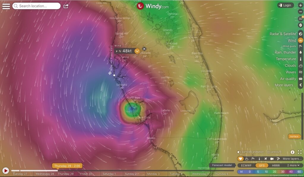
Hurricane Ian forecast path prior to landfall.
Hurricane Ian forecast windy.com

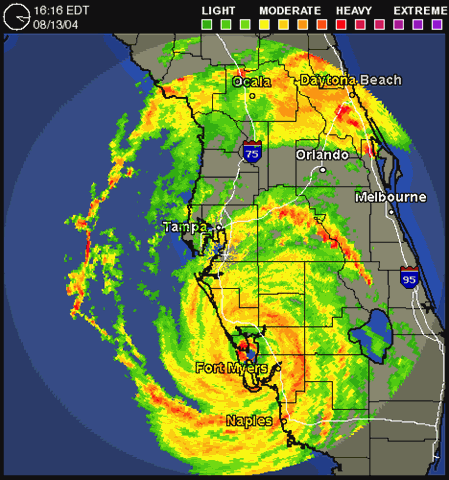
Similarly to Hurricane Charley in 2004, Hurricane Ian trended right during the last few hours before landfall, lashing Anna Maria Island with gusty winds from the north but little rain, and no storm surge, while exploding into Captiva Island 70 miles south, leaving a devastating wake of crushed and submerged houses, downed trees, washed out bridge to the mainland, and flooded cars and boats over a wide swath from Fort Myers to Port Charlotte and inland. Storm surge was reported to be up to 18 feet above sea level. 114 people died.

Hurricane Nicole made an east coast landfall near Vero Beach, Florida, with 75 mph (120 km/h) sustained winds. Nicole then weakened to a tropical storm inland, as it moved across Central Florida. Later that day, its center briefly emerged over the Gulf of Mexico, north of Tampa, before moving onshore again northwest of Cedar Key. Impact on Anna Maria Island was minimal.

Hurricane Nicole skirted Tampa Bay and Anna Maria Island November 10, 2022.

Complete List of Storms 2022

NameDateCatMax
wind
mph (km/h)
Areas affectedDeaths
AlexJune 5–6TS70 (110)Yucatán Peninsula, Western Cuba, Florida, Northern Bahamas, Bermuda4
BonnieJuly 1–2TS50 (85)Trinidad and Tobago, Grenada, Colombia, Venezuela, ABC Islands, Central America (before crossover)4
ColinJuly 1–2TS40 (65)South Atlantic United States1
DanielleSeptember 1–8Cat 190 (150)Western Iberian PeninsulaNone
EarlSeptember 3–10Cat 2105 (165)Northern Leeward Islands, Puerto Rico, Bermuda, Newfoundland2
FionaSeptember 14–24Cat 4130 (215)Lesser Antilles, Puerto Rico, Dominican Republic, Eastern Bahamas, Turks and Caicos Islands, Bermuda, Eastern Canada31
GastonSeptember 20–26TS65 (100)AzoresNone
IanSeptember 23–30Cat 4155 (250)Trinidad and Tobago, Venezuela, Colombia, ABC islands, Jamaica, Cayman Islands, Cuba, Southeastern Coast of the United States?157
HermineSeptember 23–25TS40 (65)Canary IslandsNone
ElevenSeptember 28–2935 (55)NoneNone
TwelveOctober 4–735 (55)NoneNone
JuliaOctober 7–9Cat 185 (140)Trinidad and Tobago, Venezuela, ABC Islands, Colombia, Central America (before crossover)91
KarlOctober 11–15TS60 (95)Southern Mexico3
LisaOctober 31 – November 5Cat 185 (140)Jamaica, Cayman Islands, Central AmericaNone
MartinNovember 1–3Cat 185 (140)NoneNone
NicoleNovember 7–11Cat 175 (120)The Bahamas, Southeastern Coast of the United States11
Categories
Environment

2021 Atlantic Hurricane Season Review

2021 became the third most active season on record with 21 named storms, and the sixth year in a row of above average of storms of prior seasons. April forecasts projected slightly higher activity than average.

The first named storm Ana formed May 22, earlier than the official start of the Atlantic hurricane season of June 1 to November 30.

July 1 began with Hurricane Elsa, an early strong storm, causing major damage to Barbados then again on the US east coast after crossing northern Florida and Georgia.

The forecast trajectory of Elsa put Anna Maria Island on watch several days ahead for proximal impact but the storm weakened as it traveled up the west gulf coast as a tropical storm and passed by with below gale force wind and minor rain. The highest gust reported at Sarasota Airport was 54mph. About 2.8” rain fell locally. One Florida man was killed by a falling tree.

Hurricane Elsa forecast path July 2, 2021

Hurricane Ida began August 23 in the Caribbean Sea and intensified rapidly into a category 1 hurricane as it hit Cuba with 80mph winds. Then Ida continued to strengthen over the warm Gulf of Mexico waters into a category 4 storm with 150mph winds, making landfall in Louisiana at a wind strength tying the records of 1856 and 2005 (Katrina).

Anna Maria Island and Florida west coast were unaffected.

Hurricane Ida forecast path August 27, 2021

The complete list of 2021 Atlantic named storms:

NameDateCategoryMax WindAffected
AnaMay 22 – 23TS45Bermuda
BillJune 14 – 15TS65East Coast of the United States, 
Atlantic Canada
ClaudetteJune 19 – 22TS45Southern 
Mexico, 
Southern United States, 
Atlantic Canada
DannyJune 27 – 29TS45South Carolina, 
Georgia
ElsaJuly 1 – 9Cat 185Lesser Antilles, 
Venezuela, 
Greater Antilles, 
South Atlantic United States, 
Northeastern United States, 
Atlantic Canada, 
Greenland, 
Iceland
FredAugust 11 – 17TS65Lesser Antilles, 
Greater Antilles, 
The Bahamas, 
Southeastern United States, Eastern 
Great Lakes Region, 
Northeastern United States, Southern 
Quebec, 
The Maritimes
GraceAugust 13 – 21Cat 3125Lesser Antilles, 
Greater Antilles, 
Yucatan Peninsula, Central Mexico
HenriAugust 16 – 23Cat 175Bermuda, 
Northeastern United States, Southern 
Nova Scotia
IdaAug 26 – Sep 1Cat 4150Venezuela, 
Colombia, 
Cayman Islands, 
Cuba, 
Southern United States, 
Northeastern United States, 
Atlantic Canada
JulianAug 28 – 30TS60None
KateAug 28 – Sep 1TS45None
LarryAug 31 – Sep 11Cat 3125Lesser Antilles, 
Bermuda, 
East Coast of the United States, 
Nova Scotia, 
Newfoundland, 
Saint Pierre and Miquelon, 
Greenland
MindySep 8 – 10TS45Colombia, 
Central America, 
Yucatán Peninsula, 
Florida, 
Georgia, 
South Carolina
NicholasSep 12 – 16Cat 175Mexico, 
Gulf Coast of the United States
OdetteSep 17 – 18TS45East Coast of the United States, 
Atlantic Canada
PeterSep 19 – 23TS50Hispaniola, 
Leeward Islands, 
Puerto Rico
RoseSep 19 – 23TS50None
SamSep 22 – Oct 5Cat 4155West Africa, 
Leeward Islands, 
Puerto Rico, 
Bermuda, 
Iceland
TeresaSep 24 – 25Sub TS45Bermuda
VictorSep 29 – Oct 4TS65None
WandaOct 31 – Nov 7TS50Southern United States, 
Mid-Atlantic states, 
Northeastern United States, Bermuda, Atlantic Canada
2021 Atlantic Hurricane Season Storm Tracks
Categories
Sports

Surf Report from White Ave, Holmes Beach

Live beach cam: https://amipost.com/surf-cam-holmes-beach/

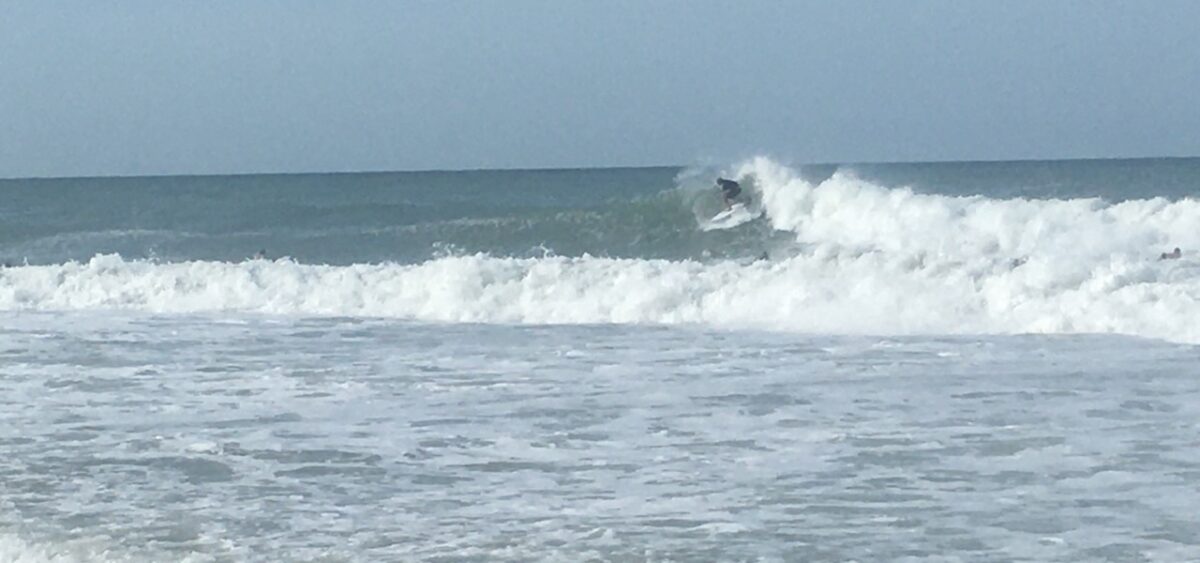
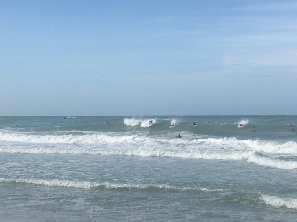
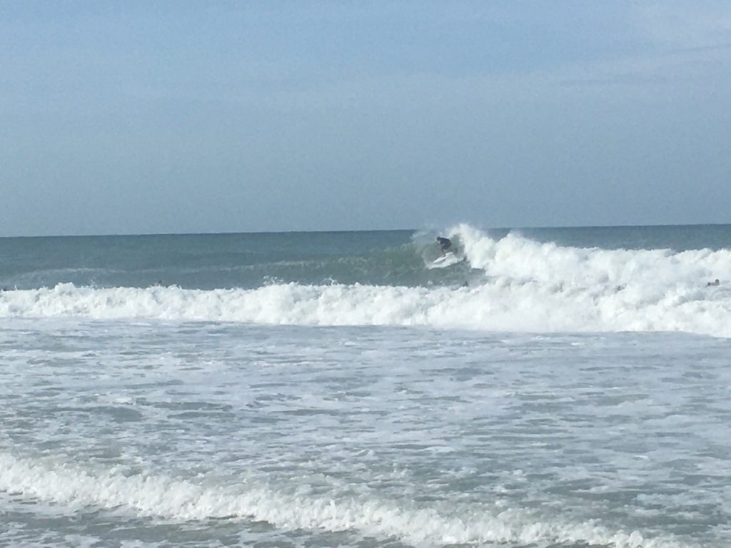
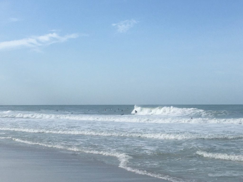
  • Surf from Hurricane Ida August 29, 2021
Hurricane Ida passing by August 28th, 2021.
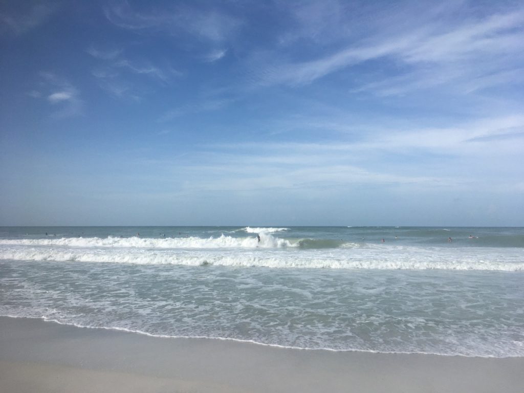
Holmes Beach, Anna Maria Island, Florida. Small surf as Tropical Storm Marco crosses Gulf of Mexico to Louisiana.
Tropical Storm Marco crossing western Gulf of Mexico, August 23, 2020.
Tropical Storm Marco, August 24, 2020, pushing out some swells.
Categories
Environment

2021 Atlantic Hurricane Season Forecast

2021 is likely to be “near normal” in terms of tropical activity, though there is more risk of an active season. Impacts from landfalling hurricanes could shift eastward this season toward the U.S. East Coast and the Leeward Islands. 

The forecast for the 2021 Atlantic Hurricane Season from June-November shows the likelihood for a near normal season, with 

  • tropical cyclone activity at ~107% of normal anticipated 
  • range of activity from 97-119% of normal 
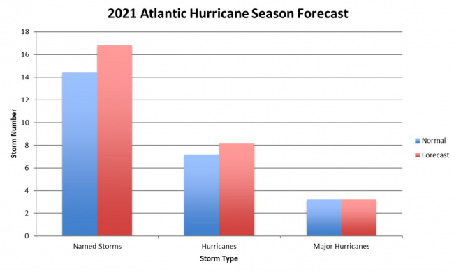
  • 17 named storms (average 14)
  • 8 hurricanes  (average 7)
  • 3 major hurricanes (average 3)

Unlike last season, the 2021 outlook does not include a hyperactive season within the expected range of outcomes, though there is very little chance for below normal activity this season. It should be noted that a “normal hurricane season” now represents higher levels of tropical activity in all aspects because of the climatology update uses 1991-2020 as the baseline instead of 1981-2010 period used previously. If 2021 outlook was issued based on the previous climatology, the forecast would call for an active season instead of a near normal one. 

2021 Storm Forecast (red) compared to normal (blue)

The Greek alphabet will no longer be used to extend the named storms’ list. If all names in the first list have been used, a supplemental list will begin.

Background:
The major ocean basins’ data support a near to above normal season of tropical activity once again. Beginning with ENSO (El Niño Southern Oscillation), there is an 80% chance of neutral or La Niña conditions being in place by the August-October peak of hurricane season, with only a 20% chance of El Niño. 

La Niña is the most favorable state for active Atlantic seasons as it supports low vertical wind shear needed for tropical cyclone formation and intensification, so the strong likelihood of neutral or La Niña conditions in 2021 suggests an active year while the slight El Niño chance reduces that potential. 

The Atlantic Multi-decadal Oscillation (AMO) shows an 80% chance to be in its favorable warm Sea Surface Temperature (SST) phase for Atlantic tropical activity. 

The largest question is the Indian Ocean Dipole (IOD), which has a connection to Atlantic occurrence of dry air that suppresses tropical cyclone formation. In 2021, there are questions about the state of the IOD by August-October, which supports a nearer to normal hurricane season. 

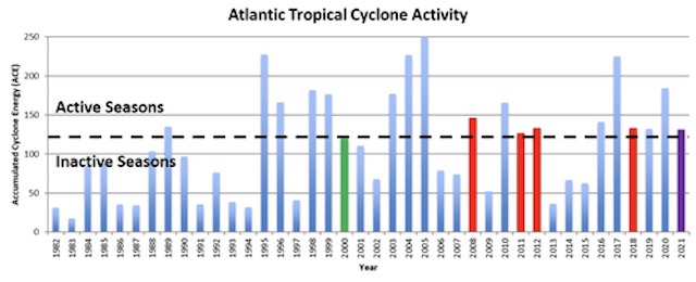
The most reliable forecast variable is Accumulated Cyclone Energy (ACE), which is widely viewed as the best measure of cyclone activity instead of the total named storm number and hurricane number. Since tropical cyclones vary wildly in duration from 1-10+ days, similar numbers of storms in different years can still represent very different levels of activity. 

The spread among the storms is relatively narrow, with 20% of the years showing below normal activity while the other 80% showed above normal activity. Due to the narrow range among prior years relative to the new normal level of activity, 100% of the prior years used in the forecast are in the “near normal” range. This results in a high confidence outlook for near to above normal activity in 2021, with the direction of ENSO and the IOD being the key issues to monitor.  

The data used in the forecast and current SST anomalies both indicate the U.S. East Coast being at the greater risk for higher impacts than usual, based on warm ocean waters off the coastline. If the model holds, any developing tropical cyclone that moves across the Western Atlantic approaching the U.S. will have ample energy to become a high-impact hurricane if other environmental conditions allow. There is also a consensus for slightly warmer than normal SST around the Leeward Islands of the Caribbean Sea, making that another area to watch for high-end impacts this season. Gulf of Mexico SST is not low but  not near the record warmth of last year. 

Annual Atlantic seasonal  tropical cyclone activity from 1982-2021, with 2000, 2008, 2011, 2012, and 2018 highlighted in red for active, green for inactive seasons (June-November), and the 2021 forecast highlighted in purple.
Annual Atlantic seasonal  tropical cyclone activity from 1982-2021, with 2000, 2008, 2011, 2012, and 2018 highlighted in red for active, green for inactive seasons (June-November), and the 2021 forecast highlighted in purple.
Categories
Environment

2020 Atlantic Hurricane Season Review

Summary:

An active 2020 summer storm season passed by Anna Maria Island with minor effects. Hurricane Eta caused a surprisingly high storm surge and flooding overnight coinciding with a high tide. A local business man died from electrocution after touching a flooded appliance.

  • Above average storm activity
  • No Anna Maria Island evacuations
  • 2 landfalls on Florida Gulf Coast, Sally and Eta
  • Minor damage from Eta 2′ surge, which flooded some low-lying Anna Maria Island properties. Minor squalls and rainfall.
Fastest growing storms of 2020
US Mainland landfalls 2020

“I think really what stood out to me about 2020 was the extremely active late season. October and November were extremely active with seven storms and a whopping four major hurricanes (Delta, Epsilon, Eta and Iota).” said Phil Klotzbach, lead author of the forecast at CSU.

The causes of the active year, according to NOAA’s lead seasonal hurricane forecaster Gerry Bell, included warmer-than-average Atlantic sea-surface temperatures and a stronger west African monsoon, along with wind patterns coming off Africa that were more favorable for storm development. 

“These conditions, combined with La Niña, helped make this record-breaking, extremely active hurricane season possible.”

While it’s clear warmer ocean temperatures make storms stronger, there’s still vigorous debate among top climate scientists on the question of whether warmer waters lead to a greater number of tropical systems. 

 “My colleagues and I feel that the jury is very much out on the topic of global tropical cyclone frequency,” said Dr. Kerry Emanuel from MIT, a leading researcher on how climate change affects hurricanes. While this Atlantic season was extreme, he points out that what we see in the Atlantic Basin is not representative of the rest of the globe. “Only about 12 percent of the world’s tropical cyclones occur in the Atlantic, and globally it has not been a very exceptional year.”


Atlantic Hurricane Season
 April 2020 forecast 2020 Actual
Named storms (>35mph)       13  30
Hurricanes (>72mph)        8  13
Major hurricanes (>111mph)        4  9
US landfall likelihood    55%  40% (12)
Gulf Coast landfall    32%  30% (9)
Florida landfall 7% (2) Keys and panhandle

The Named Storms of 2020:

NameActive PeriodPeak Strength
mph
TS ArthurMay 16-1960
TS BerthaMay 27-2850
TS CristobalJune 1-1050
TS DollyJune 21-2445
TS EdouardJuly 4-645
TS FayJuly 9-1160
TS GonzaloJuly 21-2565
Hurricane HannaJuly 23-2790 (Cat 1)
Hurricane IsaiasJul 28-Aug 585 (Cat 1)
TS JosephineAug 11-1645
TS KyleAug 14-1650
Hurricane LauraAug 20-29130 (Cat 4)
Hurricane MarcoAug 20-2575 (Cat 1)
TS OmarAug 31-Sep 540
Hurricane NanaSep 1-475 (Cat 1)
Hurricane PauletteSep 7-23105 (Cat 2)
TS ReneSep 7-1450
Hurricane SallySep 11-18105 (Cat 2)
Hurricane TeddySep 12-24140 (Cat 4)
TS VickySep 14-1750
TS BetaSep 17-2560
TS WilfredSep 18-2140
TS AlphaSep 18-1950
TS GammaOct 2-670
Hurricane DeltaOct 4-12145 (Cat 4)
Hurricane EpsilonOct 19-26115 (Cat 3)
Hurricane ZetaOct 24-29110 (Cat 2)
Hurricane EtaOct 31-Nov 13150 (Cat 4)
TS ThetaNov 10-1570
Hurricane IotaNov 13-18160 (Cat 5)
Hurricane Laura track
Hurricane Laura track August 20 – 29, 2020, becoming Cat 3 near landfall
Tropical Storm Isaias July 28 – August 5, 2020
Hurricane Delta October 4 – 12, 2020
Hurricane Zeta October 24 – 29, 2020
Hurricane Zeta wind field October 28, 2020
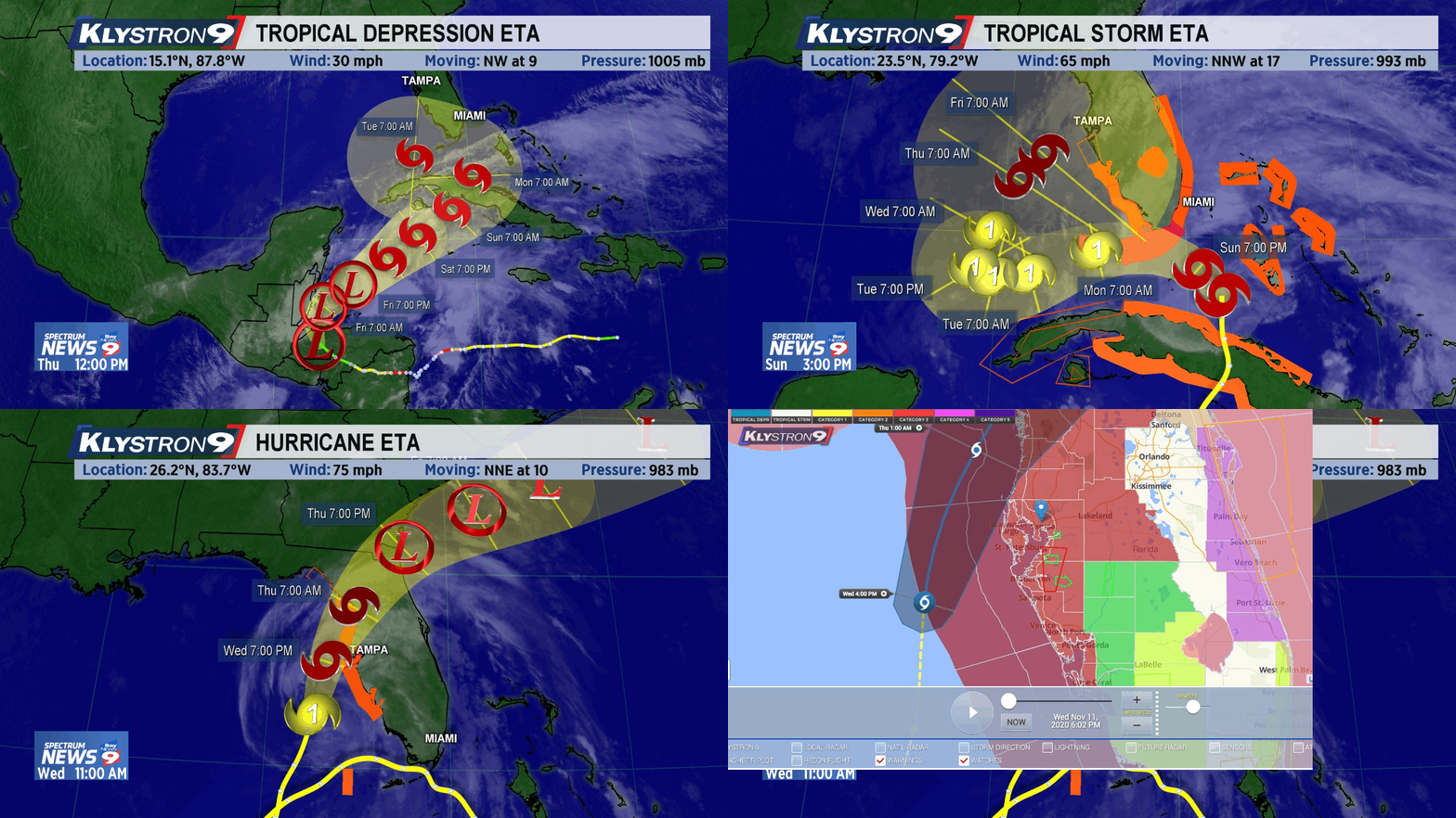
Tropical Storm Eta tracked west into central America causing widespread damage then returned east to cause havoc to Cuba, the Keys, and then north off the Florida west coast as Cat 4 hurricane October 24 – 28, 2020, weakening at time of landfall.

For detailed discussion of factors contributing to 2020 storm weather, see CSU meteorology (pdf).