Categories
Environment

Hurricane Hermine Hits Holmes Beach Hard

Ficus blown over by wind gust. Culverts did not drain.
A Ficus tree blown over by a wind gust. Culverts did not drain.

On August 18th, a weather disturbance in the Atlantic Ocean formed into an area of tropical interest and labelled “Invest 99L” by meteorologists. For ten days it crept across the ocean and meandered in the eastern Caribbean. By Monday August 29th, Tropical Depression 9 hatched, and unconstrained by prior nearby steering winds headed into the Gulf of Mexico to become Tropical Storm Hermine on Wednesday.

2016 TD9 in Florida Straights becomes Tropical Storm Hermine, then Hurricane Hermine at landfall.

West Florida went on high alert. Storms this close sometimes run up the coast like Tropical Storm Debby (2012), sometimes change direction suddenly or quickly intensify like Hurricane Charley (2004). In any case Hermine looked like it would be a rain-maker like Tropical Storm Colin earlier this year.

Blocked drain and overwhelmed percolation pits.

Anna Maria Island residents experience nature’s best and worst conditions. Summer storms can be brief and invigorating or inconvenient and terrifying. Hermine kept offshore but the effects stayed around for 3 days, tossing 9″ of rain, 45mph wind bursts, frequent lightning and massive thunder booms from waves of storm-bred feeder bands.

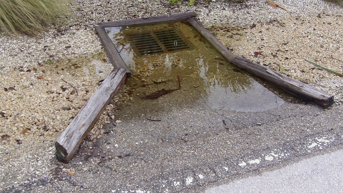
Combined with 2½ feet of surge on top of 2½ foot high tides, torrential and long-lasting rainfall overwhelmed the newly installed “percolation” pit drainage, causing what many people described as the worst flooding they have ever seen on the island. Schools closed Thursday, roads became impassable, and sewers backed up. Power stayed on apart from a short outage when a falling tree brought down some lines.

Categories
Environment

2015 Atlantic Hurricane Season Review

2015 Atlantic Storm tracks

Summary:

  • Below average storm activity with fewest named storms since 1993
  • No impacts on Anna Maria Island
  • No landfalls on Florida
  • A record 65-straight hurricanes in the Atlantic have missed Florida
  • Last storm (Wilma) to hit Florida was 10 year ago, an all time record lull.
  • 1 Gulf of Mexico storm (TS Bill)
  • 1 US mainland landfall (TS Ana, pre hurricane season)
  • 2 major hurricanes (Cat 3 Danny and Cat 4 Joaquin)
Atlantic Hurricane Season April 2015 forecast 2015 Actual
Named storms (>35mph) 7 11
Hurricanes (>72mph) 3 4
Major hurricanes (>111mph) 1 2
US landfall likelihood 28% 9%
Gulf Coast landfall 15% 9%

The Named Storms:

Ana – Tropical Storm, May 8-11. Earliest on record. Landfall North Myrtle Beach, South Carolina.

Bill – Tropical Storm, June 16-18. Landfall Matagorda Island, Texas.

Claudette – Tropical Storm, July 13-14

Danny – Hurricane Cat 3, August 18-24

Erika – Tropical Storm, August 25-29, impacting Dominica, Guadalupe, Puerto Rico, and Haiti.

Fred – Hurricane Cat 1, August 30 to September 6, first ever impact on Cape Verde Islands.

Grace – Tropical Storm, September 5-9

Henri – Tropical Storm, September 8-11

Ida – Tropical Storm, September 18-27

Joaquin – Hurricane Cat 4, September 28 to October 8, impacting Bahamas, and sinking cargo ship El Faro.

Kate – Tropical Storm, November 9-12

Categories
Environment

2015 Atlantic Hurricane Season Forecast

The first early forecast for the 2015 hurricane season has been released by the Colorado State University Tropical Meteorology Project, predicting another quiet year:

We anticipate that the 2015 Atlantic basin hurricane season will be one of the least active seasons since the middle of the 20th century.
It appears quite likely that an El Niño of at least moderate strength will develop this summer and fall.
The tropical and subtropical Atlantic are also quite cool at present.
We anticipate a below-average probability for major hurricanes making landfall along the United States coastline and in the Caribbean.

– Drs Philip J. Klotzbach and William M. Gray, Colorado State University, April 9, 2015

Atlantic Hurricane Season April 2015 forecastAverage
Named storms (>35mph winds)  7
12
Hurricanes (>72mph winds)  3  6.5
Major hurricanes (>111mph winds)  1   2
US landfall likelihood28%52%
Gulf Coast landfall probability15%30%
Major Hurricane in Caribbean probability22%42%
Manatee County hurricane landfall probability *0.3%0.7%
Manatee County tropical storm probability*8.1%17.1%
Manatee County >75mph wind gusts probability*2.3%5.0%

Early season forecasts are based on historical statistics and computer models that predict outcomes using climatological conditions present in January to March. The CSU model has been accurate in predicting above or below average seasons 23 out of 33 times, or 70%.

Measurements used include sea surface temperature, sea level pressure, and zonal wind strengths. Eastern tropical Pacific conditions in August to October, such as weak trades, low SST and SLP, are associated with La Nina formation, which is conducive to high activity in the tropical Atlantic. High SST, SLP and strong trades prevent warm air propagating from Western Pacific to the tropical Atlantic area and is referred to as El Nino, which correlates to a quieter Caribbean summer.

2015 Western Pacific Sea Surface Temperature Anomaly – El Nino
Categories
Environment

2014 Atlantic Hurricane Season Review

2014 Atlantic Storm tracks

Summary:

  • Below average activity with fewest named storms since 1997
  • No effects on Anna Maria Island
  • No landfalls on Florida
  • 1 Gulf of Mexico storm (TS Dolly)
  • 1 US mainland landfall (Arthur)
  • 2 major hurricanes (Cat 3 Edouard and Cat 4 Gonzalo)
  • The US broke a record of 9 years without a major hurricane landfall. The last major hurricane to make US landfall was Wilma (2005). The previous record of eight years was from 1861-1868.
  • Florida broke a record of 9 years without a hurricane impact (since 1851). The previous record of five years was from 1980-1984.
Atlantic Hurricane Season June 2014 forecast 2014 Actual
Named storms (>35mph) 10 8
Hurricanes (>72mph) 4 6
Major hurricanes (>111mph) 1 2
US landfall likelihood 40% 12%
Gulf Coast landfall 23% 12%
Categories
Environment

2014 Atlantic Hurricane Season Forecast

The 2014 hurricane season has arrived and the extended range summer analysis forecasts below-average activity and landfall strike possibility.

“We continue to foresee a below-average 2014 Atlantic hurricane season. The tropical Atlantic remains slightly cooler than normal, while El Niño is in the process of developing. However, the transition to El Niño has slowed some in recent weeks, and the tropical Atlantic has anomalously warmed, causing us to increase our forecast slightly. We are still calling for a below-average probability of United States and Caribbean major hurricane landfall.”

Drs Philip J. Klotzbach and William M. Gray, Colorado State University, June 2, 2014

Atlantic Hurricane Season June 2014 forecastAverage
Named storms (>35mph winds) 10
12
Hurricanes (>72mph winds)  4  6.5
Major hurricanes (>111mph winds)  1   2
US landfall likelihood40%52%
Gulf Coast landfall probability23%30%
Manatee County hurricane landfall probability0.5%0.7%
Manatee County tropical storm probability12.3%17.1%
Manatee County >75mph wind gusts probability3.5%5.0%

Information obtained through May 2014 indicates that the 2014 Atlantic hurricane season will have less activity than the median 1981-2010 season. The probability of U.S. major hurricane landfall is estimated to be about 80 percent of the long-period average. An anticipated below-average Atlantic basin hurricane season is due to the likelihood of El Niño development along with a slighter cooler than normal tropical Atlantic.

Exit mobile version